
Henry County is accepting requests for proposals (RFP) for the design of wetland and / or stream restoration on county-owned property off Butler’s Bridge Road. The RFP also includes design work for a future trail system on the property.
The Butler’s Bridge Road property — referred to as the South River Site in county documents — consists of 44.35 +/- acres. The property was purchased in 2004 through funds received from the state’s now defunct Georgia Greenspace Program. There have been no improvements on site since the county’s acquisition of the property.
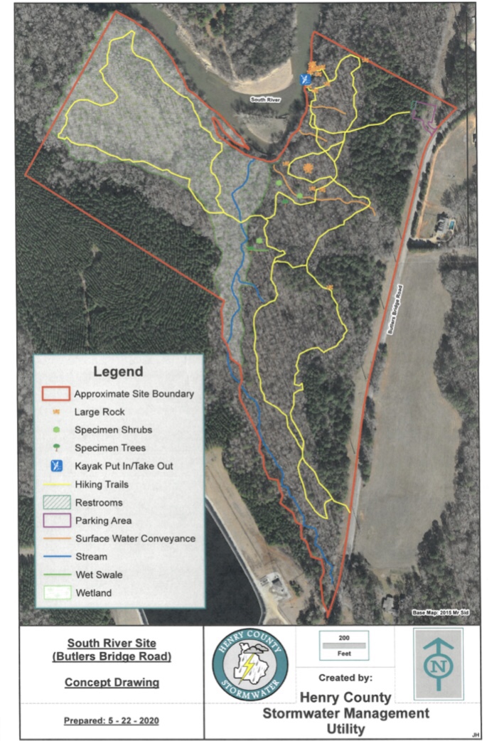
About 1,700 linear feet of the property’s northern boundary borders the South River. About twenty acres of FEMA special flood hazard area, twelve acres of wetlands, and two streams exist on the property. Three historical farming fields are located in upland areas of the site.
The watershed improvement focus of the project is to restore the property to pre-farming natural conditions. This will be accomplished by removing man-made drainage features and restoring the property to pre-farming elevation contours.
In addition, the RFP includes design work for primitive walking trails through upland portions of the property and evaluating the feasibility of a boardwalk traversing the wetland / floodplain. A dedicated trail to an access point along the South River is desired to allow the transport of kayaks and canoes for recreational use. Currently, there are no other designated South River access points in Henry County.
Proposals are being accepted through August 31 at 3:00 pm. The project is funded through Henry County Stormwater.
Construction of the project will be bid out in a subsequent future letting following the completion of design work.
Be the first to comment